Monster Hail, Powerful Tornadoes, and Destructive Storms Expected Across Multiple States
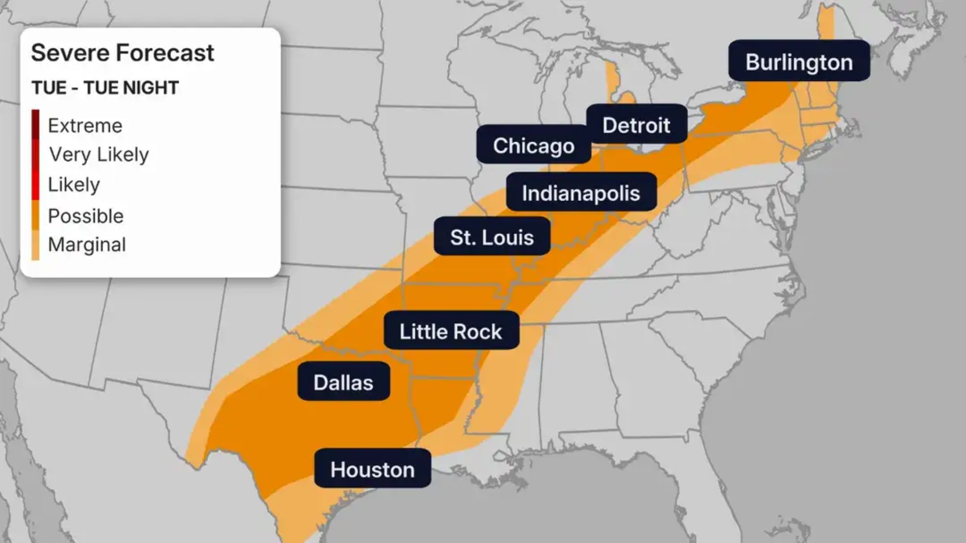

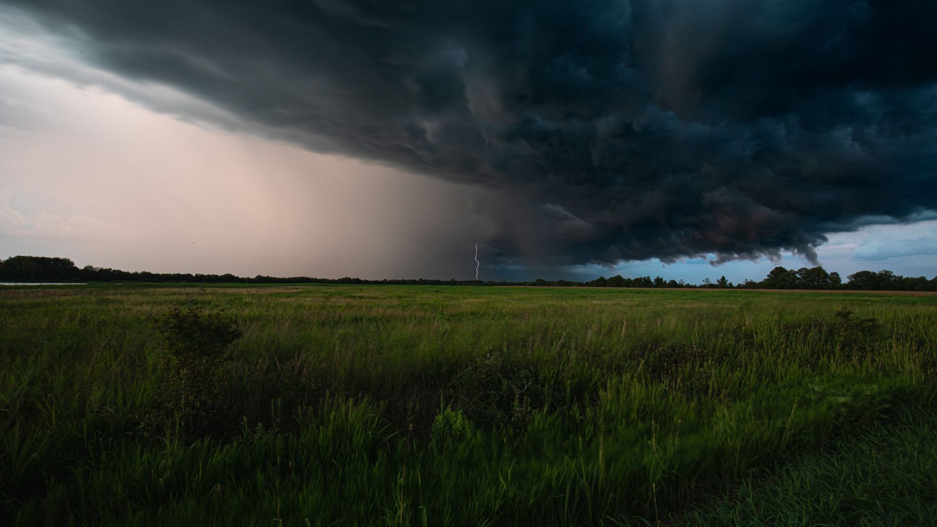
A dangerous storm system that began tearing through the Plains on Sunday is still moving, and today it is heading for tens of millions more people. As the cold front pushes east on Tuesday, 57 million people remain under a slight risk for severe storms capable of hail, wind, and tornadoes, from southwest Texas all the way to northern New England. This is the same system that collapsed homes in Nebraska two days ago. It has not finished.
More than 25 possible tornadoes were reported across Kansas, Nebraska, Minnesota, and Iowa on Sunday alone, according to preliminary reports from NOAA’s Storm Prediction Center. Some of the worst damage was recorded in Hall and Howard counties in Nebraska, where video showed two people and a dog being pulled from the rubble of a collapsed home in St. Libory. By Monday, the threat had intensified further, with a rare Level 4 of 5 severe weather risk issued for the Central Plains — a designation forecasters apply only around 14 days per year.
The broader severe weather threat on Monday covered more than 80 million people across a 1,000-mile corridor from North Texas to western New York, with violent EF3-or-stronger tornadoes and softball-sized hail among the primary hazards. By Tuesday, the storm system has shifted east, but it has not weakened into insignificance. New states are now in its path, and the damage toll from the full three-day outbreak is still being counted.
What Sunday Left Behind and Why Monday Looked Worse
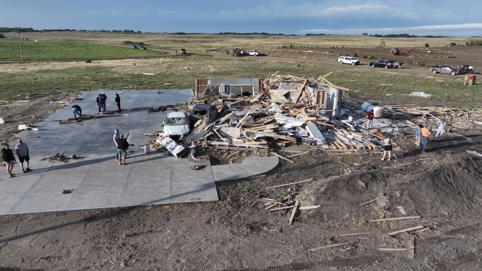
Sunday’s storms produced about two dozen tornado reports, baseball-sized and larger hail, and wind gusts over 70 mph across parts of Nebraska, Kansas, South Dakota, and northwest Iowa. A tornado emergency, the most significant type of tornado warning reserved for when forecasters are certain a large and damaging twister is incoming, was issued near Hebron, Nebraska, just north of the Kansas border. At least one home was destroyed. Tornado emergencies are rare; Sunday had more than one.
Tornadoes also touched down in Nebraska on Sunday, with at least three homes sustaining major damage, and widespread devastation was seen in St. Paul, Nebraska, including torn roofs, scattered debris, and shells of homes. The storms also stretched into South Dakota and Iowa. Wind gusts of 82 mph were recorded near Estherville, Iowa, where a grain elevator was damaged. Additional tornado damage was reported north of Ashland, Nebraska, and homes near Plattsmouth, south of Omaha, were also struck. National Weather Service survey teams were dispatched across multiple states to confirm the full count and intensity of twisters.
Monday escalated the crisis. The Storm Prediction Center issued a particularly dangerous situation tornado watch for northeast Kansas and far southeast Nebraska, a rare designation that signals stronger, potentially long-lasting tornadoes are possible. Supercells capable of EF3-or-stronger tornadoes and softball-sized hail were forecast to fire between 1 p.m. and 5 p.m. CT, with Manhattan, Topeka, and Wichita squarely in the highest-risk zone. A tornado emergency was also issued near Pawnee City, Nebraska, as a large, life-threatening twister moved through the area Monday evening.
Fewer Tornadoes, But Millions Still at Risk

Severe storm and tornado potential drops on Tuesday as the weather system pushes east, but a Level 2 of 5 risk of severe thunderstorms extends from northern Texas to Michigan. Damaging winds and hail are the primary threats, arriving both from lingering morning storms and new ones developing in the afternoon. The hail threat is highest across Texas on Tuesday, while the isolated tornado risk is focused on the eastern Great Lakes, interior Northeast, and northern New England. Lower risk does not mean no risk, particularly for communities caught off guard.
Widely scattered severe thunderstorms are possible along a cold front extending from the Great Lakes into the Ohio Valley and the Southern Plains on Tuesday, with damaging winds and large hail as the primary threats. Convection ongoing from the mid-Mississippi Valley is being driven east by the cold front, with additional afternoon thunderstorm development possible into the Northeast, carrying potential for large hail and damaging wind. Flash flooding is also a concern, with forecasters warning of 1 to 2 inches of rainfall from northern Minnesota through northeastern Texas as the storm line pushes through.
The volatile storm system is hitting an unusually volatile week across the country. The Northeast Corridor is baking in temperatures 10 to 25 degrees above average, expected to shatter records across the Ohio Valley, mid-Atlantic, and Northeast through Wednesday. Meanwhile, winter alerts remain posted for much of Wyoming and parts of Colorado, where hail and freezing temperatures are hitting simultaneously. The same cold front fueling Tuesday’s severe storms is the boundary separating those extremes, and it is still moving east.
What Forecasters Are Watching Next This May
The ferocity of this outbreak stands in sharper relief given how still May had been before it. The first two weeks of the month were unusually inactive, with a weather pattern that kept the central and eastern U.S. cooler than average while the West ran hotter. That is essentially the inverse of conditions that fuel widespread severe weather east of the Rockies. Only eight confirmed tornadoes had occurred in the first two weeks of May. Then the pattern flipped, and the atmosphere collected its debt all at once.
AccuWeather long-range forecasters had predicted that 2026 may see fewer tornadoes than last year’s headline-grabbing outbreaks, but AccuWeather Meteorologist Alex Duffus cautioned early in the season: “Flash floods and damaging wind gusts can be just as destructive as tornadoes and often impact a much larger area. It only takes one storm striking a densely populated or vulnerable community to make this a devastating season.” This week has already produced exactly that scenario, across multiple communities and multiple states.
A cold front will continue moving southeast through Wednesday and Thursday, extending across the Southern Plains and mid-Mississippi Valley into the Mid-Atlantic. A severe threat could develop along and ahead of the front each afternoon, meaning this week’s story is still being written. Damage survey teams are still in the field from Sunday’s storms. Tuesday’s full report card will not be complete until tonight. The larger question, with tornado season only halfway through May, is whether the atmosphere has released its energy — or simply paused.