Hurricane Genevieve Reaches Category 5 Before Weakening, Bringing Dangerous Waves to Mexico
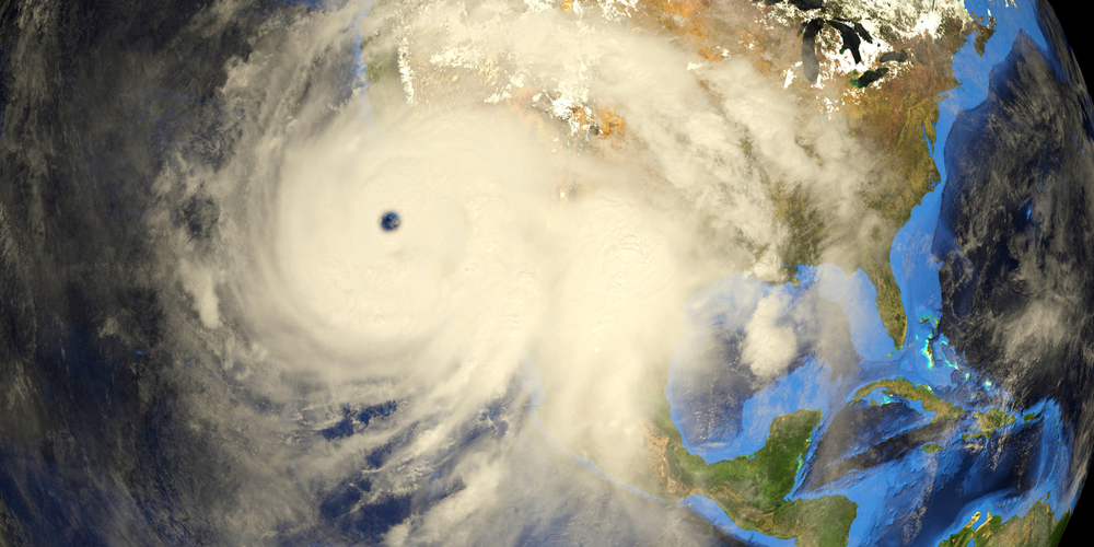

Hurricane Genevieve strengthened at an extraordinary pace over the eastern Pacific, briefly becoming the first Category 5 hurricane of the 2026 season before beginning a gradual weakening trend. Although the storm is forecast to remain offshore and avoid a direct landfall, forecasters say its powerful swells are already creating hazardous conditions along parts of Mexico’s Pacific coastline, where life-threatening surf and rip currents are expected.
The Storm Intensified With Remarkable Speed
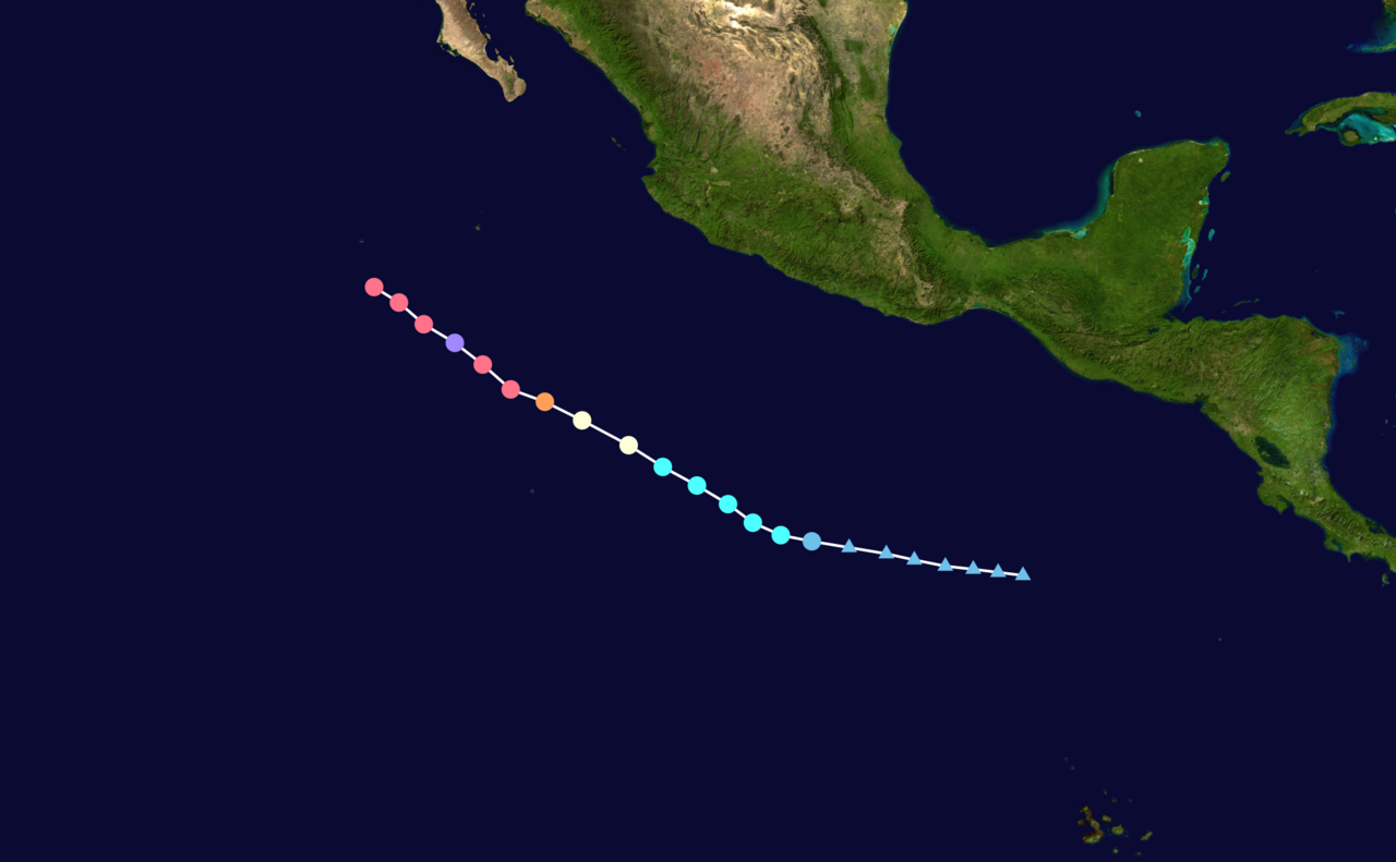
Genevieve’s development unfolded rapidly (in photo). It formed as a tropical depression (light blue circle) on July 24, became Tropical Storm Genevieve (sky blue circle) later that day, strengthened into a hurricane on July 25, intensified into a Category 4 storm (red circle) on July 26, and reached Category 5 (purple circle) status early on July 27 with maximum sustained winds of 160 mph. By later that morning, the National Hurricane Center reported the storm had weakened slightly to 155 mph, placing it back in the upper end of Category 4 strength.
What Makes a Category 5 Hurricane Different
Under the Saffir-Simpson Hurricane Wind Scale, Category 5 hurricanes have sustained winds exceeding 157 mph, making them the strongest classification for tropical cyclones. Storms of this intensity are capable of catastrophic wind damage if they strike land, although Genevieve is expected to remain well offshore. In this case, the primary concern for coastal communities comes from the ocean swells generated by such a powerful system rather than destructive winds over populated areas.
Warm Ocean Waters Fueled Its Rapid Growth

Meteorologists attribute Genevieve’s explosive strengthening to exceptionally favorable environmental conditions. The storm developed over sea surface temperatures near 30 degrees Celsius, encountered light wind shear, and moved through a very moist atmosphere. Yale Climate Connections noted that near-record ocean warmth associated with the developing El Niño helped create an environment where the hurricane could intensify unusually quickly.
Mexico Faces Dangerous Surf Despite the Offshore Track
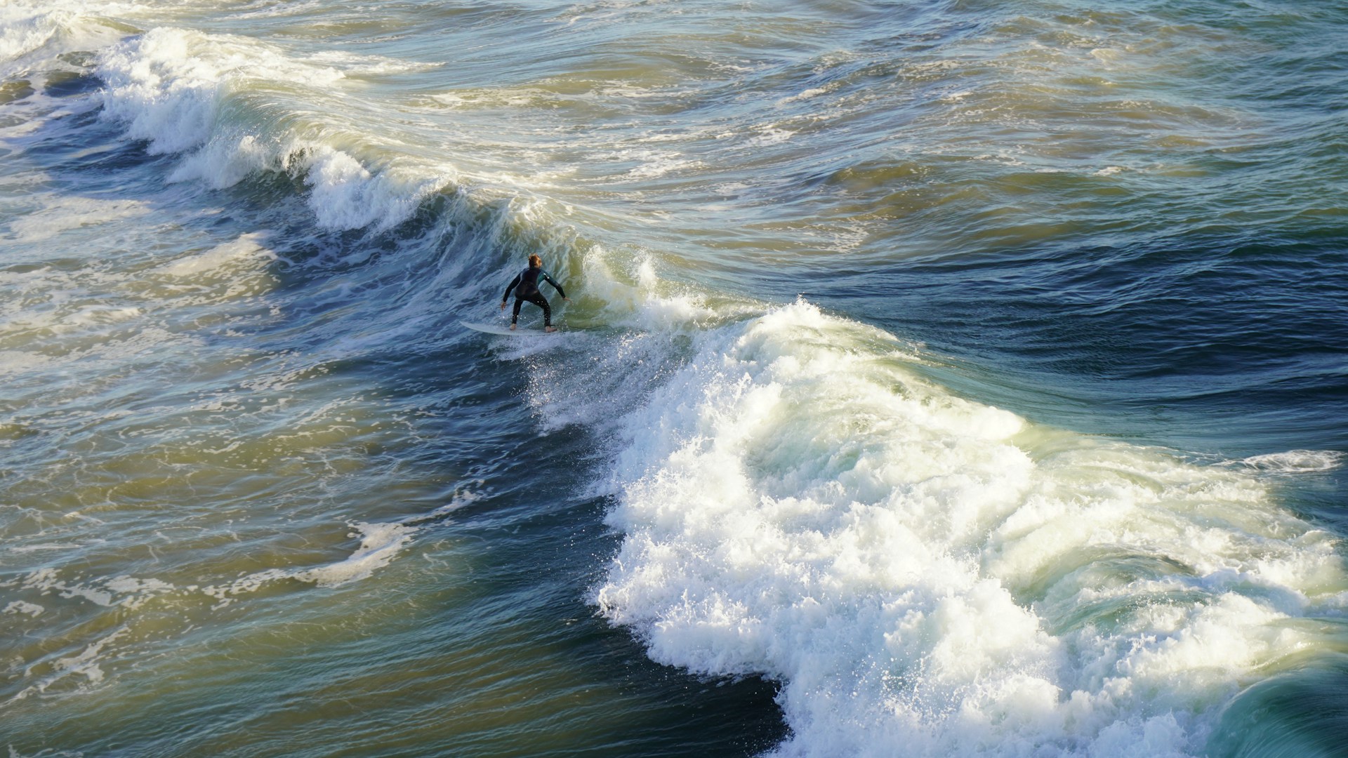
While Genevieve is forecast to remain hundreds of miles offshore, its size and strength are already affecting the Pacific coast of Mexico. Swells generated by the hurricane have begun reaching southwestern Mexico and the southern Baja California Peninsula and are expected to spread northward. The National Hurricane Center warns these swells can produce life-threatening surf and dangerous rip currents, even without the hurricane making landfall.
The Storm Could Also Affect California’s Coastline
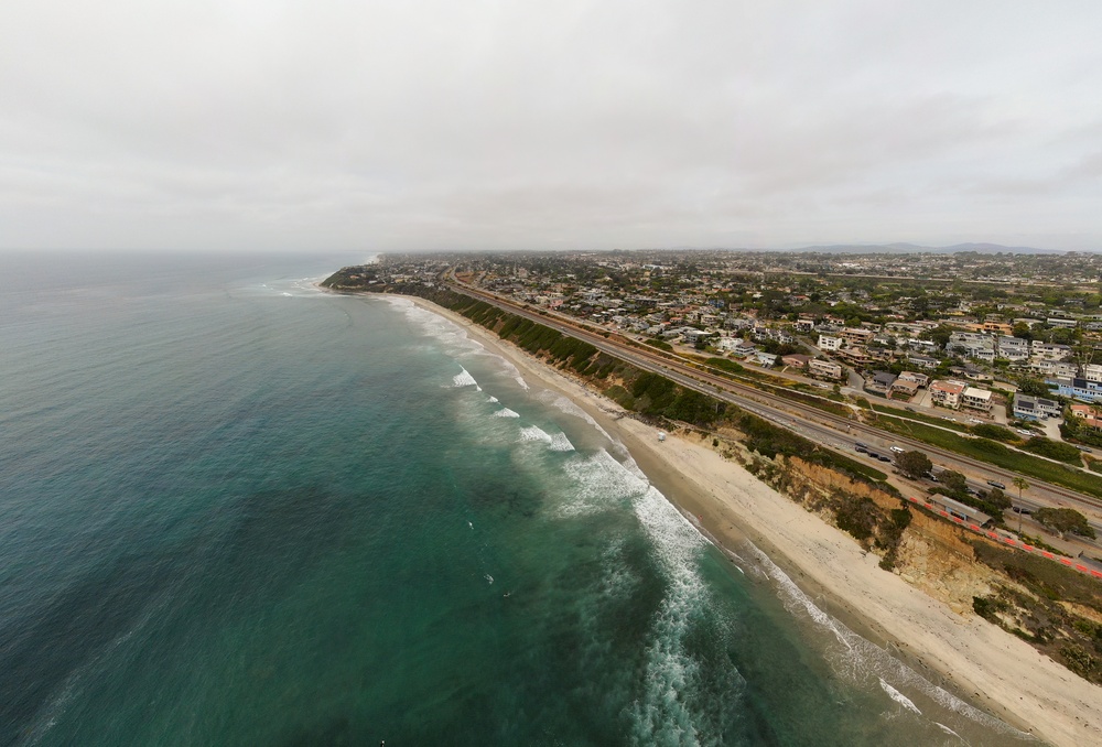
The hurricane’s impacts are expected to extend beyond Mexico. According to the National Weather Service in San Diego, long-period swells from Genevieve may combine with existing ocean conditions to generate breaking waves of roughly 9 to 11 feet at south-facing beaches later this week. Forecasters also warned that the swells, combined with higher-than-normal tides, could produce minor tidal overflow, with the potential for localized coastal flooding if conditions become more favorable.
Forecasts Show Gradual Weakening Ahead
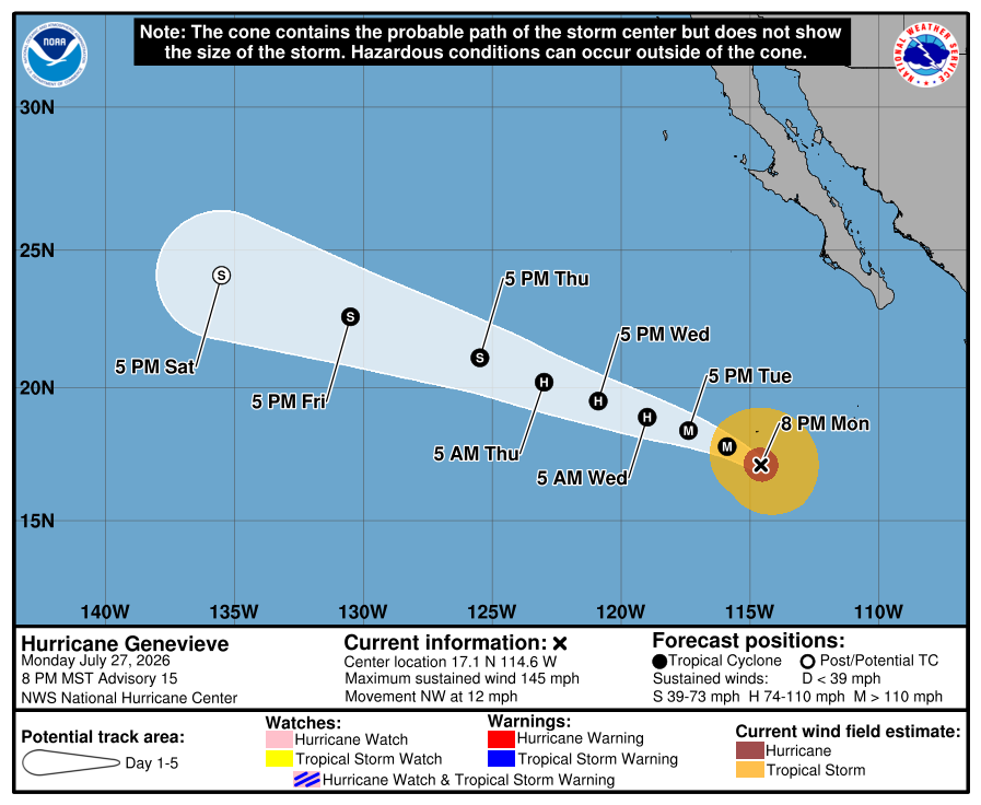
Meteorologists expect Genevieve to steadily lose strength during the second half of the week. As the hurricane moves northwest, it will encounter cooler ocean waters and increasingly dry air, reducing the energy that has sustained its rapid intensification. Forecasts indicate it will likely weaken below hurricane strength by around Friday before continuing to dissipate over the open Pacific.
Why the Storm Is Expected to Stay Away From Land

One reason forecasters have expressed cautious optimism is Genevieve’s projected path. The National Hurricane Center expects the storm to continue tracking northwest, roughly parallel to Mexico’s Pacific coastline before gradually bending farther west into the open ocean. That trajectory keeps the hurricane itself away from populated coastal areas while allowing its expansive wave field to continue affecting beaches hundreds of miles away.
The Pacific Has Been Especially Active This Season
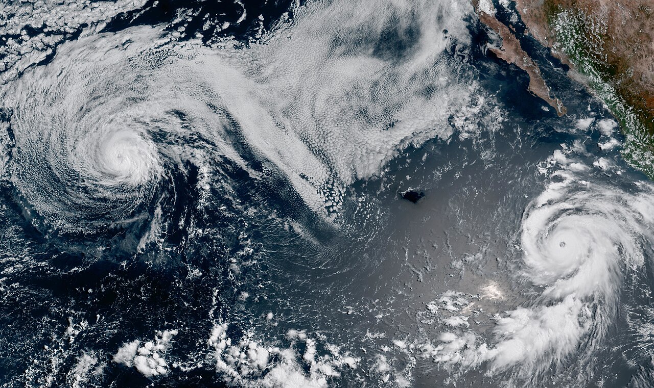
Genevieve is part of an unusually active eastern Pacific hurricane season that meteorologists have linked to strengthening El Niño conditions. AccuWeather noted that warmer ocean temperatures have helped create favorable conditions for tropical cyclone development across the basin. At the same time Genevieve (bottom right) reached Category 5 strength, Hurricane Fausto (top left) was also tracking across the Pacific, highlighting the heightened level of tropical activity this season.
Coastal Hazards May Outlast the Hurricane’s Peak
Although Genevieve’s strongest winds are expected to diminish over the coming days, the risks to beachgoers and boaters can continue long after the storm weakens. Powerful swells often travel far beyond the hurricane itself, creating dangerous surf, rip currents, and coastal flooding well away from the storm’s center. As Genevieve moves farther into the Pacific, forecasters will continue monitoring how those ocean conditions evolve along the coasts of Mexico and Southern California.