Europe’s Top Weather Model Just Shifted Its Forecast Because What’s Happening in the Pacific Should Worry You
The world’s most accurate weather forecasting system just sounded a massive alarm regarding the Pacific Ocean. While we were expecting a calm transition in 2026, the European Centre for Medium-Range Weather Forecasts now predicts a 75% chance of a “super El Niño” developing by October. This isn’t just a minor warm spell: it is a monster climatic shift that could rewrite the record books. The suddenness of this forecast update has caught the scientific community completely off guard.
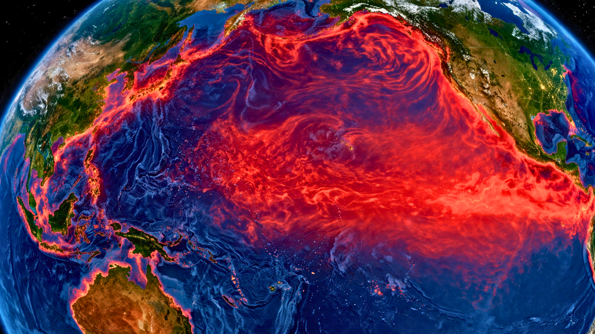
Subsurface ocean temperatures in the equatorial Pacific are behaving in ways that suggest an impending explosion of heat. Forecasters previously thought we were entering a neutral phase, but a massive pool of warm water has refused to dissipate. Instead of cooling down, this heat is rising to the surface and spreading eastward across the world’s largest ocean. This energy transfer is the primary engine behind the most extreme weather events on the planet, and it is currently accelerating.
A “super El Niño” is defined by ocean temperatures climbing more than 4 degrees above their usual averages. We have only seen this level of intensity a handful of times in modern history, specifically in years that brought catastrophic global disruptions. When the Pacific warms to this degree, it shifts the entire global jet stream, moving heat and moisture in unpredictable ways. This looming climate giant is now preparing to flex its muscles, and the initial impacts will be felt everywhere.
From Floods to Droughts: A Global Weather Overhaul
The consequences of such a powerful event are rarely subtle or localized. As the Pacific heats up, regions like Australia, Southeast Asia, and Central America often plunge into severe, bone-dry droughts. Conversely, parts of South America frequently face relentless rainfall and life-threatening floods. Because the Pacific Ocean holds so much thermal energy, its release into the atmosphere can push global temperatures to new heights, making 2026 a potential contender for the hottest year ever recorded.
The ripple effects extend far into the atmosphere, creating a tug-of-war between the world’s two major oceans. While the Pacific becomes a breeding ground for intense tropical cyclones, the Atlantic usually sees the opposite effect. High-level winds generated by El Niño create “wind shear,” a phenomenon that acts like a buzzsaw against developing hurricanes. For residents along the Atlantic coast, this might sound like good news, but the timing of this development is absolutely critical for safety.
If this warming reaches its peak between August and October, it could effectively shut down the 2026 hurricane season. However, if the development lags even slightly, coastal communities could still face a standard, or even active, storm season before the suppression kicks in. This uncertainty creates a dangerous waiting game for emergency planners. As the Pacific continues to simmer, the focus turns toward how this atmospheric chaos will manifest on a more local and personal level.
Texas Braces for a Winter of Extremes
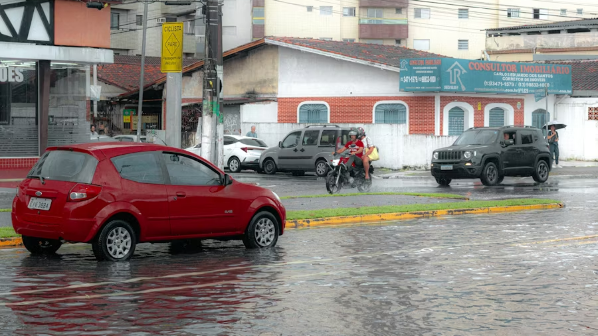
For the southern United States, particularly Texas, the “super El Niño” signal is strongest during the winter months. Historically, these years push storm systems directly across the southern tier of the country, leading to much wetter conditions than normal. While this can help replenish reservoirs, it also significantly raises the risk of localized flooding and infrastructure damage. The sheer volume of water predicted by the European model suggests that traditional flood maps might be rendered completely useless.
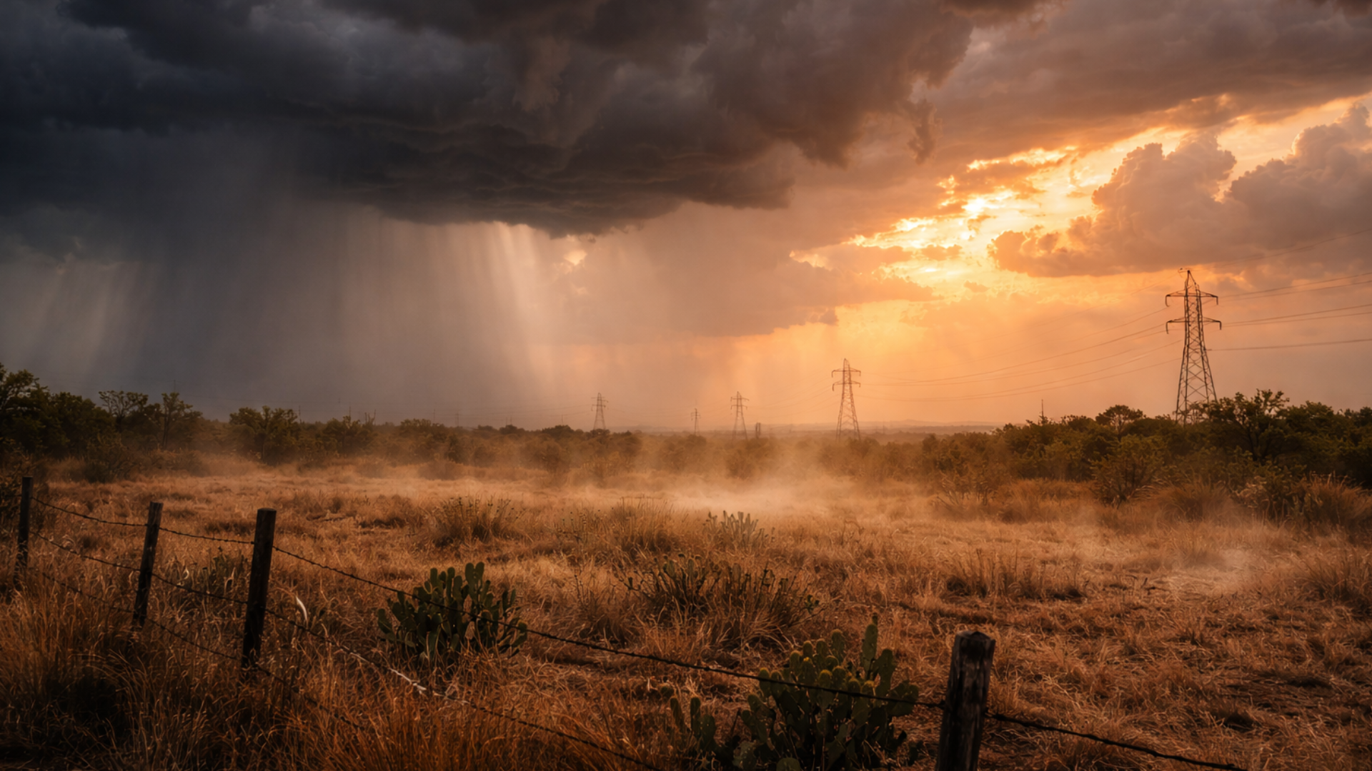
Summer weather in the Lone State is a much more complicated puzzle to solve. Interestingly, the most extreme Texas heat waves, like those in 2011 and 2022, actually occurred during the opposite cycle, known as La Niña. During those years, lack of cloud cover and dry soil allowed temperatures to skyrocket. Even with a massive El Niño forming, Texas summers are often dominated by local high-pressure systems that can trap heat regardless of what the Pacific Ocean is doing.
The real danger for residents lies in the transition periods when the weather patterns are in flux. During these windows, the cooling effect of evening temperatures often vanishes, preventing the environment from recovering from the daytime sun. This leads to a persistent, grinding heat that taxes the power grid and public health. As the European model continues to refine its projections, scientists are looking closely at the specific months when the most intense shifts will likely occur.
A Climate Precedent That Challenges Our Preparedness

Despite the confidence of the European model, American forecasters at NOAA are remaining slightly more cautious. Their current data suggests a 60% chance of development, favoring a more gradual evolution of the pattern. This discrepancy between the world’s top two forecasting agencies highlights the inherent difficulty in predicting the Pacific’s behavior during the spring months. The coming weeks will be a high-stakes period for meteorologists as they attempt to reconcile these two very different future outlooks.
The legacy of previous super-events, such as the 1997-98 or 2015-16 cycles, serves as a grim reminder of what is possible. Those years saw multibillion-dollar economic losses and permanent changes to local ecosystems. If the European model is correct, we are on the verge of a climate event that will challenge our infrastructure, our agriculture, and our disaster response systems. The window to prepare for a potentially record-breaking shift in our global environment is rapidly closing.
As we move deeper into 2026, the question is no longer if the Pacific will change, but how extreme that change will be. Will this be a manageable weather shift, or are we about to witness one of the most powerful climatic disruptions of the century? The answer lies hidden beneath the waves of the equatorial Pacific, waiting to emerge. For now, the world watches the blue waters of the eastern Pacific, knowing that their temperature will dictate our collective future.